Lets have some History Thread

@erskblue As you say, 1066 was an important in the history of the British Isles. If Harold had been victorious at Hastings we would probably be speaking and writing a very different type of English. Also would we have experienced the political, social and religious upheavals of later years especially those in the 16th and 17th Centuries? And possibly just as important would football be played and discussed?!
Possibly not but think of all those lawn bowls world championships.

 
Possibly not but think of all those lawn bowls world championships.
Indeed but then again there would be no Shed End Forum and debates about managers, players and VAR. Also no mocking of Arsenal, Spurs and Celtic.

 
Was at HMS Belfast earlier for Will Iredale's talk about his latest book: Churchill's Pirates. An excellent talk and yes, I did buy the book. I sat next to the son of one of the people mentioned in the book. His father had defused one of the magnetic mines dropped by the Luftwaffe around the British coastline. The defusing of the mine allowed the Royal Navy to take counter measures.

https://www.iwm.org.uk/events/iwm-in-conversation-will-iredale-churchills-pirates

Churchill's PiratesJoin author Will Iredale onboard HMS Belfast as he introduces his new book, Churchill's Pirates. Drawing on fascinating first-hand accounts with surviving veterans, exclusive interviews, original papers and new archive material this will be the defining story of the overlooked unit who worked night and day to keep Britain safe in her darkest hour, the Royal Naval Patrol Service.

Alongside the fascinating wartime stories, Will will bring to life the personal experiences of ordinary people whose bravery played a crucial role in Allied victory. 

Following the talk, have your questions answered 

About the book
iwml_churchills_pirates_book_cover.jpg.webp


Churchill’s Pirates was the nickname of the naval force whose “toils and tireless courage”, in the words of Churchill himself, helped the Allies defeat Hitler’s war machine. 

A rag-tag group of sailors and volunteers that came to form the Royal Naval Patrol Service.

These motley crews grew into a force of 70,000 men and women manning and supporting a fleet of 6,000 ships. Using converted fishing vessels, pleasure yachts and trawlers, they cleared sea mines, escorted merchant vessels, hunted submarines, and heroically rescued soldiers at Dunkirk, working day and night to keep Britain safe in her darkest hour.

Will Iredale brings us onto the decks of these small brave ships. This is the defining story of an overlooked unit of ordinary people that played a pivotal role in saving the country and winning the war.

About Will Iredale
iwml_will_iredale_author_portrait_text_and_media.jpg.webp


Will Iredale joined The Sunday Times in 1999, working first on the foreign news desk and subsequently the home news desk, where as a staff news reporter he specialised in general news and undercover investigations. He is currently a media consultant and lives in Kent with his family. 

His first book, The Kamikaze Hunters, about the Royal Navy's war in the Pacific in 1945 was a Sunday Times top ten bestseller. His second book, about the men and women of Bomber Command's Pathfinders in the Second World War was published in July 2021, and was also a Sunday Times top ten bestseller. 

 
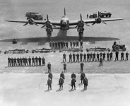
image.pngWhat it took to put a single Lancaster bomber in the air!

When you think you've had a tough day at work, it's worth reflecting on an average day for a Lancaster aircrew during the Second World War.

 
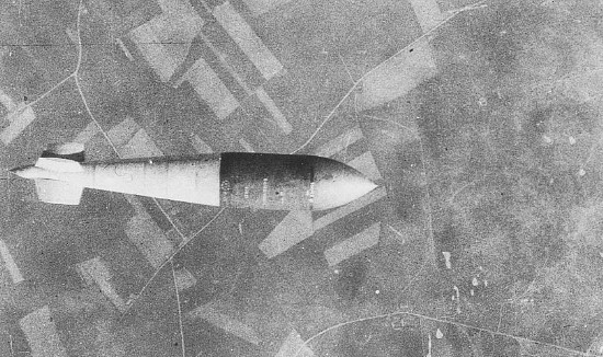
Tallboy_bomb_dump_1944.jpg
Five Tallboy bombs in a bomb dump at Bardney, Lincolnshire prior to being loaded on No. 9 Squadron RAF Lancaster bombers.

  • The Tallboy Bomb
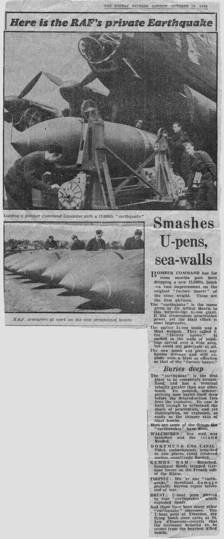
         - A Lancaster Delivered Earthquake

p_tallboy1.jpg


In the spring of 1942 the Nazis were building reinforced concrete submarine bases that were bomb-proof against any existing weapons. At this time the largest penetrating bomb available to Bomber Command weighed a mere 1000 pounds.

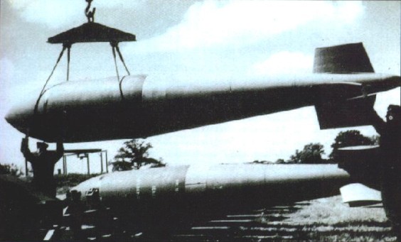
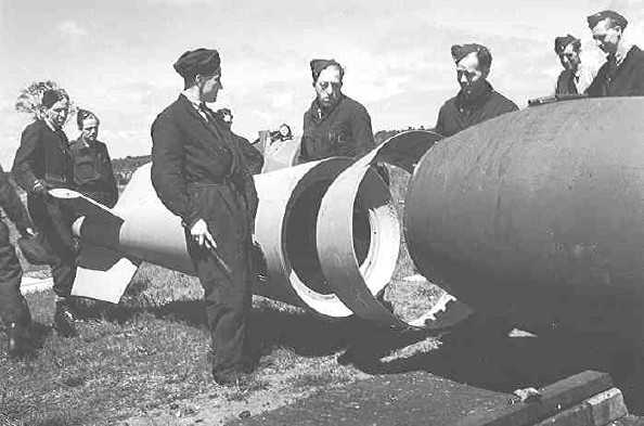
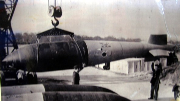
A 12,000-lb MC deep-penetration bomb (Bomber Command executive codeword 'Tallboy') is hoisted from the bomb dump to its carrier at Woodhall Spa, Lincolnshire.

It was to be loaded into an Avro Lancaster of No. 617 Squadron RAF for a raid on the V-weapon site at Wizernes,

France. 617 Squadron were unable to bomb the target on this occasion because of low cloud cover, but were to succeed two days later.

As early as the fall of 1940, the brilliant Vickers Armstrong engineer and designer of the Wellington Bomber, Barnes Wallis, had demonstrated in his research how extra-large, penetrating bombs could create an earthquake like pressure wave that would destroy nearby structures by displacing their foundations. Wallis was envisioning a weapon weighing 20,000 pounds that would be dropped from an altitude of 40,000 feet, and reach the speed of sound. Known as the "Tallboy," there was no aircraft in the foreseeable future that could carry it so the design was put on hold.

Following the success of Wallis's "Bouncing Bomb" in the Dambusters Raid, his Tallboy design was reviewed. There was still no aircraft capable of carrying the original design to 40,000 feet but the Lancaster was now operational and had proven itself able to carry a 12,000 pound weapon. Wallis revised his design, including offsetting the tailfins by five degrees. This improved the weapons stability significantly. Released from the optimum height of 18,000 feet the bomb took 37 seconds to reach the ground, impacting with a speed of 750 miles per hour. During the night of June 8, 1944 the first Tallboy was dropped, causing extensive damage to the Saumur Railway Tunnel, preventing enemy reinforcements including tank units from reaching the beaches of Normandy.

Related Articles

Battleship Tirpitz
Lancaster Bomber
The Last Tallboy
60th Anniversary of Tirpitz Sinking


p_tallboy5.jpg


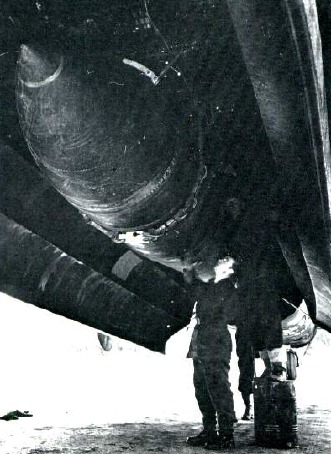
Frank Hawkins looks up at a
tallboy in position in a Lancaster's bomb bay.
The aircraft's bomb doors were modified
so that they could close around
the weapon's 38" (95 cm) diameter.


image.pngAn example of the Tallboy's effectiveness occurred when they were used against the underground V-1 assembly and launch facilities at Wizernes, France.

One caused a landslide that completely blocked an entrance to the underground storage area and on a second raid, additional landslides were caused that completely blocked the remaining four entrances.

The earthquake-effect of the weapon was demonstrated on numerous other occasions such as when a "near miss" of sixty feet was sufficient to destroy the railway bridge at Bad Oeynhausen.
p_tallboy3.jpg


By the end of the war, a total of 854 Tallboys had been dropped on heavily reinforced V-1 and V-2 assembly and launch sites, submarine pens, tunnels, oil refining and storage sites, viaducts, canals, and bridges. Its most spectacular success was with the sinking of the Battleship Tirpitz.

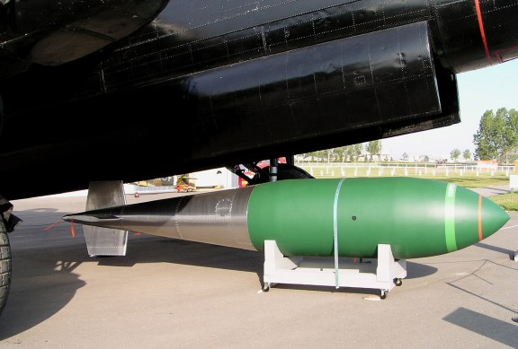
The Tallboy was 21 feet in length and 38 inches at its maximum diameter. Its hardened steel case had a thickness of more than 4 inches in the nose. The tail of the bomb was made of aluminum.

The weapon was filled with 5200 pounds of Torpex explosive and the actual detonation could be delayed up to sixty minutes.
p_tallboy2.jpg


p_tallboy6.jpg


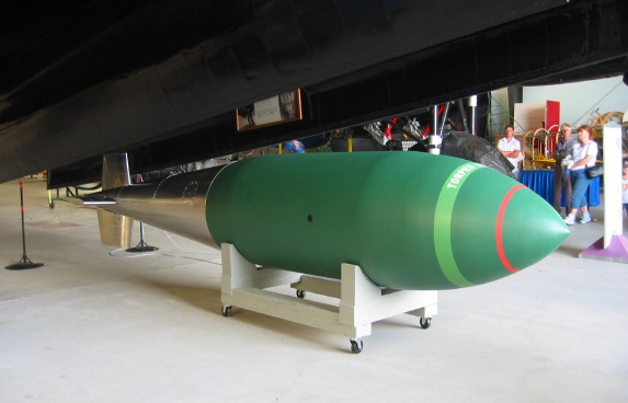
This Tallboy mock-up was built by John Morel and Andy Lockhart.
It was unveiled during the museum's commemoration of the Sixtieth Anniversary
of the Sinking of the Battleship Tirpitz.
The museum's Tallboy was made possible through a donation by S/L John Birrell M.D. (Ret'd)
and his wife F/O Dorothy Birrell R.N. (Ret'd) of Calgary.
Dr. Birrell served as a medical officer with the Royal Canadian Air Force during WW II
and his wife Dorothy was a nurse with the RCAF.


p_tallboy7.jpg


During March, 1945 a larger version of the weapon, the 22,000 pound "Grand Slam" became operational. With a length of 25 feet, 5 inches and a diameter of 46 inches, this bomb required the complete removal of the Lancaster's bomb bay doors. A total of 41 Grand Slams were dropped during the closing days of the war.

p_tallboy4.jpg


Grand Slam


p_tallboy8.jpg


Bomber Command Museum of Canada

 
As today is the anniversary of the Battle of Stamford Bridge. No, not a punch-up when Chelsea play Leeds but when the Anglo-Saxons beat Harald Hardrada's Norse army.


Battle of Stamford Bridge​

The Battle in the North of England on 25th September 1066 where King Harold crushed the attempt of Harold Hardrada, King of Norway, to take the throne of England with the aid of Harold’s brother Tostig and a Viking army

Battle of Stamford Bridge on 25th September 1066Battle of Stamford Bridge on 25th September 1066
The previous battle in the British Battles series is the Battle of Ashdown

The next battle in the Norman Conquest is the Battle of Hastings

To the Norman Conquest index

War
: Norman Conquest

Date of the Battle of Stamford Bridge: 25th September 1066

Place of the Battle of Stamford Bridge:
8 miles to the east of York in Northern England

Combatants at the Battle of Stamford Bridge: An Anglo-Saxon army against an army of Vikings, Scots, Flemings and English.

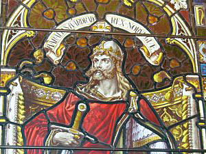
Harold Hardrada from a window in Orkney Cathedral: Battle of Stamford Bridge on 25th September 1066Harold Hardrada from a window in Orkney Cathedral: Battle of Stamford Bridge on 25th September 1066
Commanders at the Battle of Stamford Bridge:
Harold, King of England commanded the Anglo-Saxon army against Harold Hardrada, King of Norway and Earl Tostig, King Harold’s renegade brother.

Size of the armies at the Battle of Stamford Bridge: The kernel of King Harold’s army was his body of house-carls, numbering around 2,000 men. The main part of his army comprised the ‘fyrd’ levied in each district of the kingdom.

King Harold gathered the fyrd as he marched north to meet the Viking incursion, until they numbered around 8,000 men.

Harold Hardrada arrived in the north of England with a fleet of 200 Viking longships.

This fleet probably brought around 8,000 fighting men.

After leaving a guard for the ships at Riccall, Harold Hardrada marched with an army that probably numbered around 6,000 men.

Uniforms, arms and equipment at the Battle of Stamford Bridge:

Both armies were infantry forces, fighting on foot.

Such armour as was worn comprised shirts or long tunics of chain mail.

Those soldiers that could afford them wore pot helmets, some with a nose piece.

Long shields were carried.

Weapons were spears, swords and axes with sharpened agricultural tools for the peasant soldiers.

Some soldiers were armed with short bows, but they were not of decisive significance on the battlefield as the English archers were to become with the devastating longbow of the 100 Years War.

Winner of the Battle of Stamford Bridge: King Harold won the battle, Harold Hardrada and Tostig being killed with much of the Viking army.

Events leading to the Battle of Stamford Bridge:

Edward the Confessor, King of England, died on 5th January 1066.

The Witan, the Great Council of England, elected Harold Godwinsson, Earl of Wessex, his successor as king.

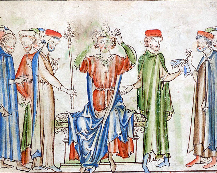
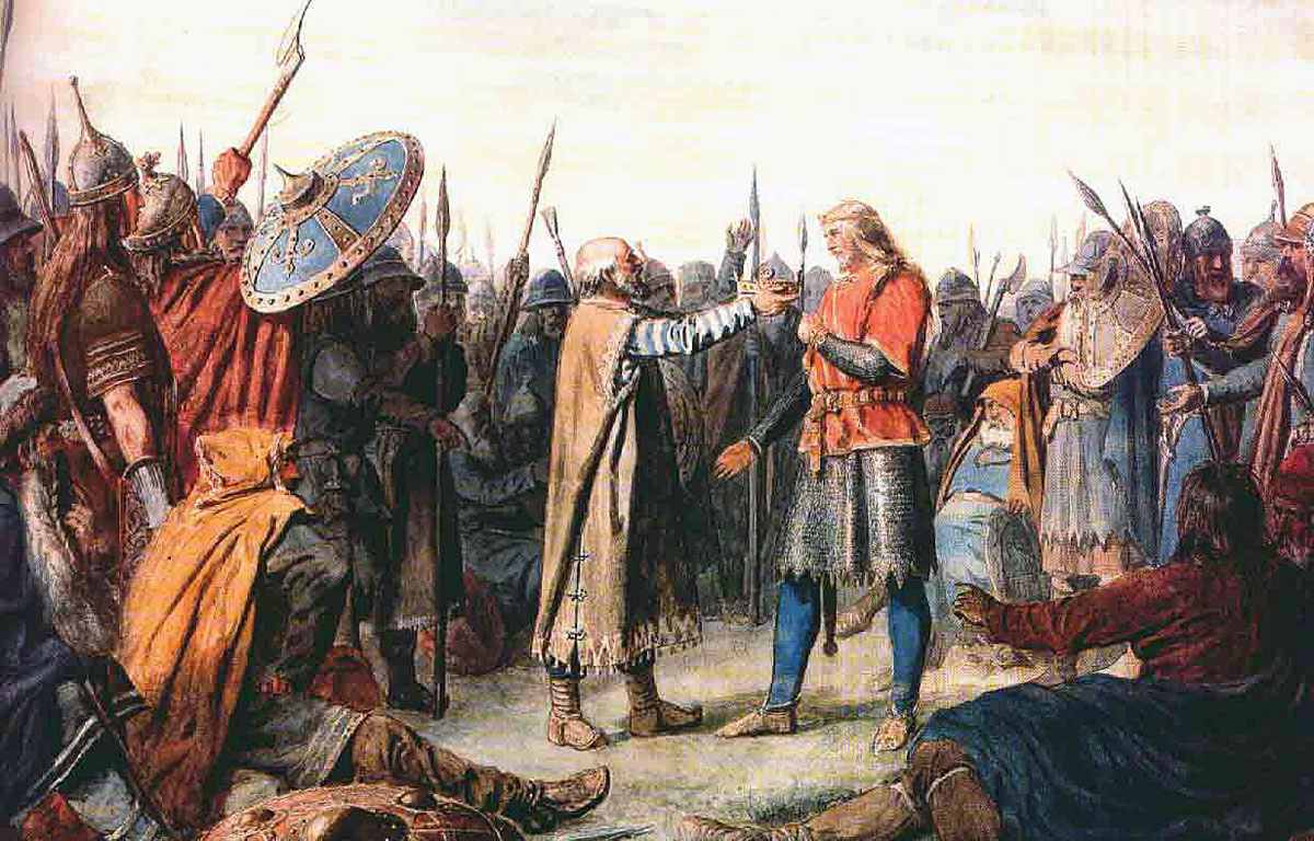
Crowning of Harold Godwinson as King of England 6th January 1066Crowning of Harold Godwinson as King of England 6th January 1066
These were times of peril for England. Two other powerful rulers considered themselves the rightful King of England: William, Duke of Normandy, who prepared an invasion across the English Channel and Harold Hardrada, King of Norway.

The first rebellion against the new King Harold was launched by his brother Tostig.

The rebellion failed and Tostig took refuge in Scotland, from where he encouraged Harold Hardrada to invade England.

King Harold was in London in September 1066 when he heard that the Viking army of Harold Hardrada had crossed the North Sea and entered the Humber estuary, sailing up the River Ouse and landing at Riccall, south of the City of York.

At some point the Vikings were joined by Tostig.

Leaving a body of his 8,000 strong Viking army at Riccall to guard the long ships, Harold Hardrada advanced on York, 10 miles to the north, across a marshy landscape.

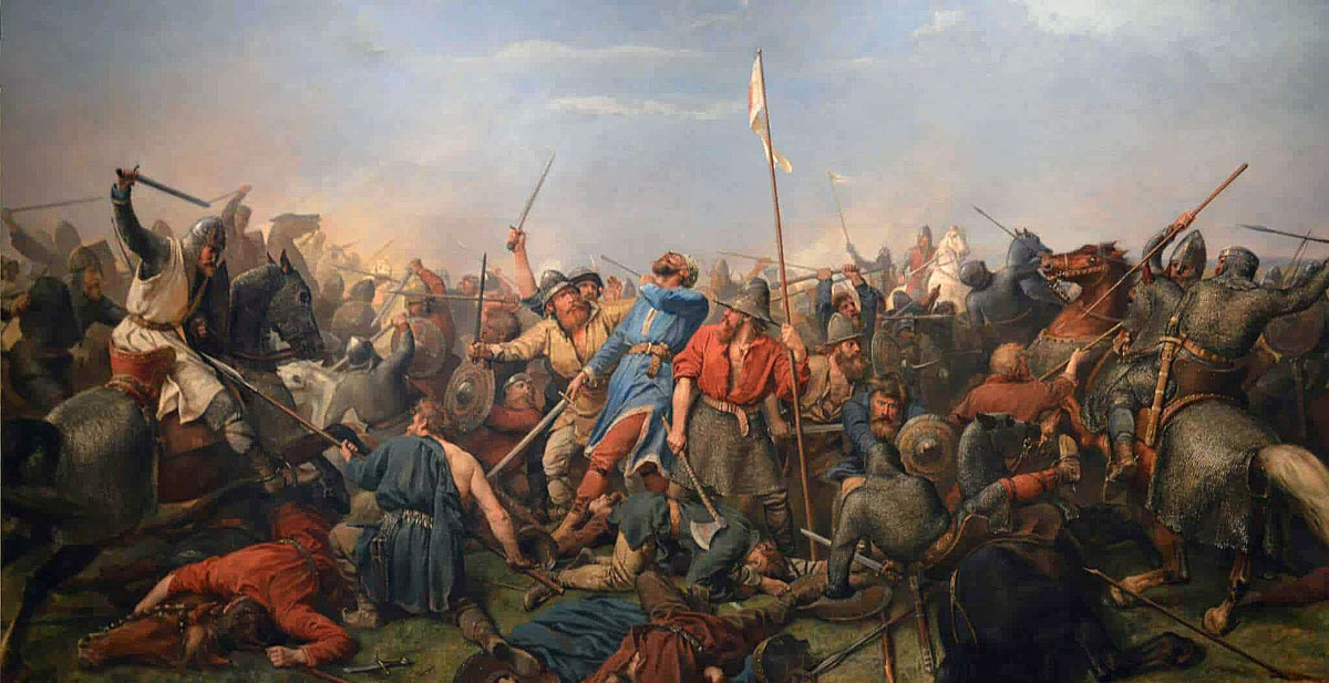
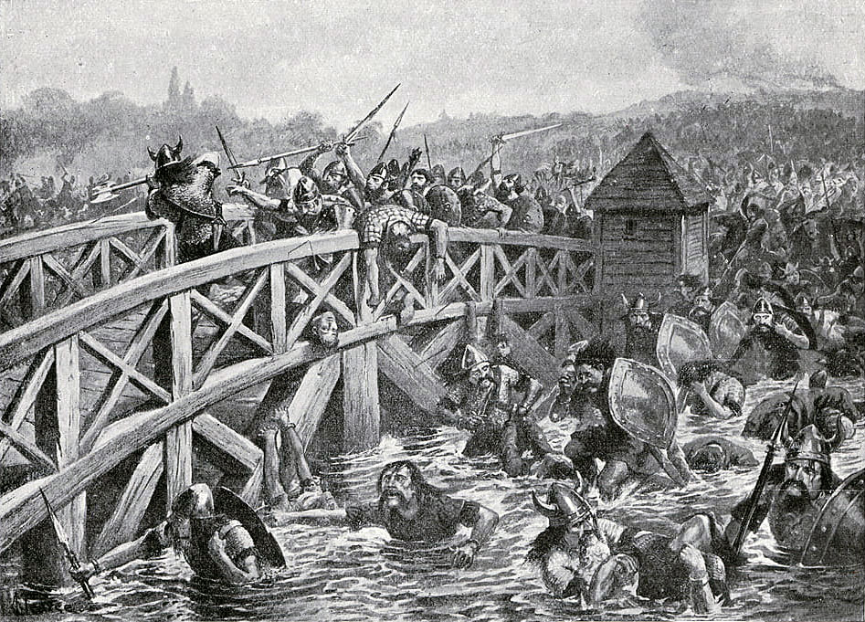
Battle of Stamford Bridge on 25th September 1066: picture by Alfred PearseBattle of Stamford Bridge on 25th September 1066: picture by Alfred Pearse
Harold Hardrada’s invasion was opposed by the Earls of Northumbria and Mercia, Edwin and Morcar and an army raised from their earldoms.

Edwin and Morcar advanced out of York to meet the approaching Vikings.

The opposing armies met at Fulford on 20th September 1066.

After a hard-fought battle Harold Hardrada drove the earls’ army off the field with great slaughter, many of the Anglo-Saxons being drowned in a ditch that ran alongside the road to York.

Instead of marching on York which was now largely defenceless, Harold Hardrada’s army fell back to Riccall.

Negotiations took place with the City of York for its surrender.

The terms of the agreement reached required the city to deliver hostages to Harold Hardrada.

Under the agreement these hostages were to be handed over at Stamford Bridge, a point between the city and Riccall, where a number of roads met at a bridge over the River Derwent.

Harold Hardrada’s Viking army marched to Stamford Bridge, where he encamped, leaving the army’s long ships at Riccall.

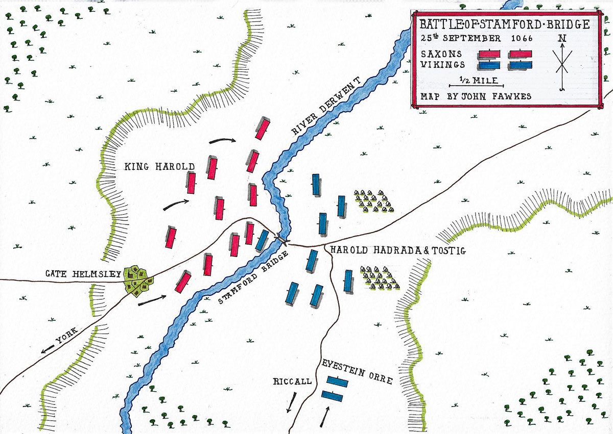
Map of the Battle of Stamford Bridge on 25th September 1066: battle map by John FawkesMap of the Battle of Stamford Bridge on 25th September 1066: battle map by John Fawkes
Account of the Battle of Stamford Bridge:


On 25th September 1066, soon after his arrival at the rendezvous, Harold Hardrada was surprised by the appearance on the far bank of the River Derwent of King Harold with his house carls and the English troops he had assembled during his four-day march from London to Stamford Bridge.

In the course of his rapid journey north, King Harold had sent messengers in advance, warning the local magnates of his arrival and the need for a substantial force of troops to meet Harold Hardrada’s Vikings.

Harold Hardrada’s army, in camp on the eastern bank of the River Derwent, was taken by surprise, unprepared for battle, many without their armour or weapons.

There were outposts from the Viking army on the west bank of the river and they hurried to stop King Harold’s men from crossing the bridge, while Harold Hardrada sent messengers to his subordinate, Eyestein Orre to bring up the reserve guarding the ships at Riccall, as quickly as possible.

The Saxons swept aside the Viking outposts on the west bank of the River Derwent, before advancing on the bridge, which they needed to cross to attack the main Viking army, hurriedly assembling on the far bank.

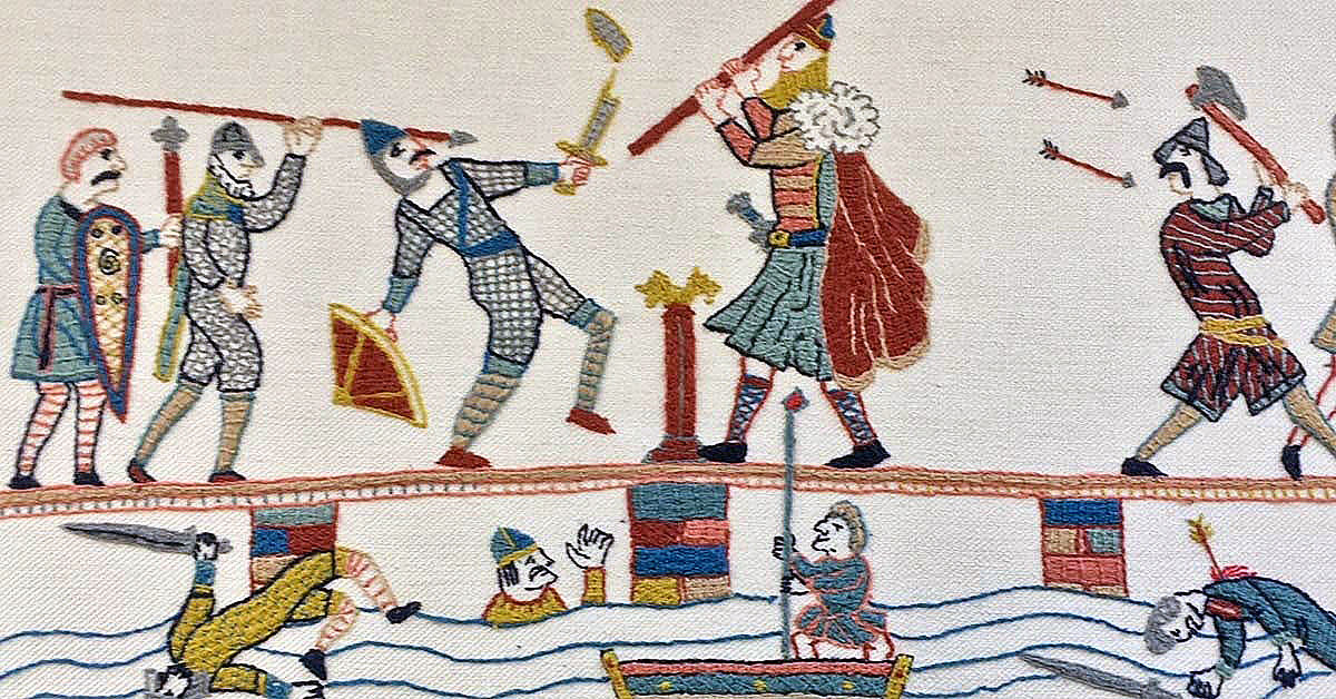
King Harold’s passage across the bridge was held up for some time by a single Viking ‘berserker’ who struck down every Saxon trying to pass him.

Death of the Viking 'berserker': Battle of Stamford Bridge on 25th September 1066Death of the Viking ‘berserker’ at the Battle of Stamford Bridge on 25th September 1066
The ‘berserker’ was finally neutralised by a Saxon manoeuvring a swill-tub under the bridge and spearing the Viking through a gap in the walkway, allowing the Saxon army to pour across the bridge and attack Harold Hardrada’s unprepared army.

The Vikings formed a shield wall, which after some hours of hard fighting the Saxons penetrated.

Harold Hardrada was killed by an arrow or slingshot, leaving Tostig to take command.

Eventually Eyestein Orre arrived with the rear-guard, but it was too late. The Viking army, now leaderless, was beaten and slaughtered by the victorious Saxons.

Eyestein Orre and Tostig died as their soldiers were overcome.

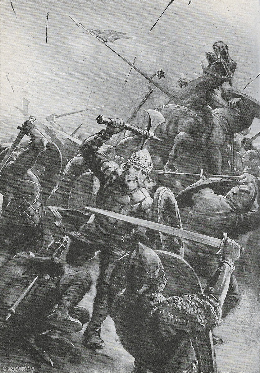
Battle of Stamford Bridge on 25th September 1066: picture by Christopher ClarkBattle of Stamford Bridge on 25th September 1066: picture by Christopher Clark
Casualties at the Battle of Stamford Bridge:


Most of the army of Harold Hardrada and Tostig became casualties.

King Harold’s losses were heavy, particularly among his housecarls, leaving him to recruit a further army to confront Duke William of Normandy at the Battle of Hastings.

Follow-up to the Battle of Stamford Bridge:

Following the Battle of Stamford Bridge, King Harold was compelled to march south to meet the invasion of Duke William of Normandy with his army of Normans, Bretons and Frenchmen landing on the southern coast in Sussex.

Earl Tostig: Battle of Stamford Bridge on 25th September 1066Earl Tostig: Battle of Stamford Bridge on 25th September 1066
The diversion of King Harold with his army to the north of England and his losses at Stamford Bridge at the very time when Duke William was crossing the Channel and landing on the Sussex coast was a major element in Harold’s defeat at the Battle of Hastings and the success of the Norman invasion.

References for the Battle of Stamford Bridge:

Battles in Britain 1066 to 1547 by William Seymour

A History of the Art of War in the Middle Ages Volume One: 378-1278 by Sir Charles Oman.

British Battles by Grant.

The previous battle in the British Battles series is the Battle of Ashdown

The next battle in the Norman Conquestis the Battle of Hastings

To the Norman Conquest index
 
The Historic England Blog

www.heritagecalling.com

Illustration of the re-use of a Roman fort at Porchester as a burh
A BRIEF INTRODUCTION TO ARCHAEOLOGY

The Life and Times of King Alfred the Great​

Explore the story of the Saxon King often credited with being the founder of the English nation.

BY ROBIN PAGE

Originally posted:25 Oct 2022


Alfred is the only English King ever to be given the name ‘the Great’.

Perhaps alongside Harold Godwinson of 1066 fame, Alfred is the most widely known Anglo-Saxon ruler.

Alfred fought back against Viking invaders and played a role in beginning a sense of ‘English’ identity beyond the existing smaller kingdoms.

He supported retrenching Christian culture in the face of pagan invasion.

Alfred’s ‘spin doctors’​

We know a good deal about Alfred because he had a biography written about him by his contemporary Bishop Asser: the ‘Life of King Alfred’.

However, Asser was not a neutral bystander.

He was an advisor to Alfred and wanted to portray him in the best light.

There are further but briefer historical records in the Anglo-Saxon Chronicle, also begun at Alfred’s request.

England before the Vikings​

Jarring though it may seem to us today, Alfred was born into a world where there was not a unified English nation under one central ruler.

A map of the Anglo-Saxon Kingdoms of East Anglia, Mercia, Northumbria and Wessex as well as British Strathclyde, 'West Wales' ( ie Cornwall) and the Welsh principalities.
A map showing the Anglo-Saxon Kingdoms before the Viking invasions. © Ivy Close Images / Alamy Stock Photo.

Since the beginnings of Anglo-Saxon culture, several Kingdoms had coalesced out of smaller groups over time and vied with each other as to who would be ‘top-dog’ in a kind of constantly changing league-table.

The main kingdoms in Alfred’s youth were Northumbria in the north of England, Mercia in the Midlands, East Anglia on the east coast and Wessex in the south. Cornwall and Cumbria retained their own non-Anglo Saxon identities.

A map of the core territory of the Kingdom of Wessex.A map of the core of the Kingdom of Wessex, by Hel-hama, Based on Hill, an Atlas of Anglo-Saxon England.

Alfred was born at a Royal Estate near Wantage, Berkshire, in AD 849 as the youngest of many sons to Aethelwulf, King of ‘Wessex’ (the Kingdom of the West Saxons).

Their core territory was roughly southern England south of the Thames minus Cornwall in the far south-west.

Enter the Vikings​

The Vikings, initially pagan Scandinavian traders, raiders and settlers threw the ‘league table’ of kingdoms into total

Their raids, drawn by the wealth of the Anglo-Saxon Kingdoms, had begun to trouble England in the 780s AD.

The incursions of the 860s were on a much bigger scale, culminating in the arrival of the ‘Great Heathen Army’ on the coast of East Anglia in AD 865.

Alfred was still a prince at this time, and Wessex was ruled by his elder brother Aethelred.

The highly mobile Vikings began to take out the individual Anglo-Saxon kingdoms with alarming speed.

A map of England showing the campaigns of the Great heathen Army of Vikings.A map showing the routes of the ‘Great Heathen Army’ (based on Stenton ‘Anglo-Saxon England’ chapter 8 and Hill ‘An Atlas of Anglo-Saxon England’ pp. 40-41.) Source: Wikimedia Commons.

In AD 866, they moved north and exploited a civil war between claimants to the Northumbrian throne, taking York and setting up a puppet local ruler.

In 867, it was the turn of Mercia. Its ruler Burgred allied with Wessex’s army commanded by King Aethelred and Alfred.

Temporarily checked but undefeated, in 873 the Vikings returned to Mercia and deposed Burgred.

In 869, the King of East Anglia, Edmund was killed by the Vikings. East Anglia was now fully under Viking domination too.

In AD 870 to 871, the Vikings over-wintered in a fortified camp at Reading in Wessex.

Saxon forces under Aethelred and Alfred tried to oust them but were defeated.

The brothers continued fighting and won the battle of Ashdown, in which Asser tells us Alfred took the lead role. Warfare continued; Aethelred died and was succeeded by Alfred.
The Vikings under King Guthrum renewed their attack on Wessex in AD 878.

They mounted a surprise attack on the Royal centre of Chippenham (Wiltshire), where Alfred had been celebrating Christmas.

Alfred was driven into hiding in the marshes of Somerset but refused to give up, waging a guerrilla war until he could rebuild his forces.

View across a marsh landscape.The marshes of Somerset was difficult terrain for invading armies and a good base from which to wage a ‘guerrilla’ war. © Alex Ramsay / Alamy Stock Photo.

Wessex strikes back​

By Easter, Alfred established a fortified camp at Athelney, Somerset.

In his day, this would have been an island connected to other high ground by a causeway.

From here, his remaining followers sent out raids and put out feelers for support.

An early 19th-century monument commemorates his time here.

He also constructed a fortified settlement at the western end of the causeway at East Lyng.

An aerial photograph of flooding in an levels landscape with higher ground standing out as islands.King Alfred established a fortified settlement at the eastern end of the Lyng ridge.

The town was linked to the nearby stronghold and monastery at Athelney, founded by Alfred a few years earlier, and all were surrounded by the marshes of the Somerset Levels.

This image, taken at the height of the flooding in the winter of 2013/14, shows the logic behind the settlement’s location, now called East Lyng. © Historic England Archive. 27897/016.

After mustering his forces, Alfred felt strong enough to hit back in open battle and marched to ‘Ethandune’, probably Edington on the edge of Salisbury Plain, where he defeated the Viking army.

Alfred forced them to make peace and to return to East Anglia.

As part of the peace deal, Guthrum had to submit to baptism. Between 880 and 890, a formal treaty was drawn between Alfred and Guthrum.

This peace was something of a compromise, which set the respective borders as:

‘Up the Thames, and then up the Lea, and along the Lea to its source, then in a straight line to Bedford, then up the Ouse to the Watling Street’.
This treaty acknowledged on Alfred’s part that the Vikings weren’t leaving the island, with Guthrum as a recognised Christian King in East Anglia.

Western Mercia was now ruled by a pro-Wessex Mercian nobleman called Aethelred, who married Alfred’s determined and capable daughter Aethelflaed.

Aethelflaed would later rule Mercia on her own as ‘Lady of the Mercians’.


Towards one England​

Alfred has sometimes been regarded as the first king of a united England, but that was not quite the real picture in his day.

He certainly called himself King of the Anglo-Saxons (rex Angul-Saxonum) or ‘of the English’ (Angelcynn), not merely of Wessex, pointing to an aspiration for a sense of common English identity.

Victorian photograph of the statue of Alfred The Great, who holds up his sword hilt  first so it forms a cross, his other hand rests  on his grounded shield.The dedication on the plinth of the mighty Victorian sculpture of Alfred at Winchester reads: ‘to the founder of the kingdom and nation’.

But in his own time, he did not rule over all of England. © Historic England Archive. CC56_00993.

As head of the ‘Last Kingdom’ standing, he tried to exert influence over those areas outside of traditional Wessex where he could.

People in the Saxon part of Mercia used coins minted at Gloucester but in Alfred’s name, for example.

He decided the fate of previously Mercian London when it was re-occupied after the Danes left.

The new rulers of western Merica, his son-in-law and daughter, were not allowed the title of ‘King’ or ‘Queen’.

A map showing areas of Anglo-Saxon control in England south of the Thames and western England versus areas of Viking domination in East Anglia, the East Midlands and the North.

A map of England showing the situation after King Alfred’s treaty and the areas of Viking control. © Michelle Bridges / Alamy Stock Photo.

It was completely out of Alfred’s reach to determine matters in Northumbria even if he had wanted to, however.

As we’ve seen, East Anglia was handed over to Guthrum’s followers.

He did, however, provide a starting point from which his successors could bring much of England together under the rule of the House of Wessex.

A manuscript illustration showing an Anglo-Saxon king presenting a book to a saint.Alfred’s successors, such as Athelstan (pictured here on the left presenting a book to St Cuthbert) furthered his work of uniting England. © Pictorial Press Ltd / Alamy Stock Photo.

Strategic defences​

Alfred would have seen the advantages of prepared defences in his wars with the Vikings.

He began to plan against future dangers by organising a network of defended places known as ‘burhs’.

We know them from documentary sources such as the ‘Burghal Hidage’ setting out their size, garrisons, and archaeological investigations.

A map showing the distribution of fortified places mostly in Wessex, known as burhs, as recorded in a 10th century document.Map showing the sites mentioned in the ‘Burghal Hidage’ list of defended centres. Based on information in ‘The Defence of Wessex’ by Hill and Rumble. Source: Creative Commons.

These sites varied in size and complexity but together covered strategic inland or coastal locations and offered places of security for local people and, in some cases, economic centres.

A plan of the Saxon town and burh of Lydford with the position of the Norman castle and fort in the western part of the enclosure.A plan showing the Anglo-Saxon burh at Lydford, Devon, with the later Norman additions.

The Norman fort and castle fit into a corner of the larger burh area. © Crown Copyright. Historic England Archive. MP/LYD0080.

Some were simple earthworks thrown up across a narrow promontory, between rivers, or re-occupied iron age hillforts.

Others were old Roman towns or forts whose walls were intact enough so that their circuits could be patched up or new major earthwork and wooden palisade fortifications in which towns developed.

Artist's impression showing a stone fort with improvised repairs in wood and wattle and groups of timber buildings in the interior.Reconstruction image showing how the Saxons re-used the Roman fort at Porchester as a burh. © Historic England Archive. IC081/009.

The best-preserved example where you can see above-ground remains of the earthwork defences is at Wareham, Dorset, a trading centre where two rivers meet a little inland from Poole Bay.

View along the earthwork remains of a Saxon rampart.Earthwork rampart of the Saxon ‘burh’ on the east side of Wareham in Dorset. © David Gee / Alamy Stock Photo.
Another elaborate planned burh was at Cricklade on the Thames in Wiltshire.

Many resources, including labour, had to be marshalled to build and garrison these places.

To do so, Alfred had to co-opt an existing tradition of duties to work on public infrastructure and military service.

His daughter also extended this burh system across Mercia and the network was expanded by Alfred’s successors.

King Alfred, founder of the Royal Navy?

Alfred’s forces also took to the sea to thwart Viking incursions.

We are told that he even invented new designs of ships for the purpose.

This has led to him being identified as the ‘Founder of the Royal Navy’.

However, historians have pointed out that there were existing traditions of using a fleet, including sea fights with the Vikings in his father’s time as king.

Economic reform​

Alfred reformed his coinage to bring the silver content back up to acceptable standards to help give economic stability.

The Church and learning

Alfred was not just known for military and secular achievements. He was a patron of learning and church reform.

A Saxon church built of stone.Anglo-Saxon church of St Lawrence, Brafrod-on-Avon, Wiltshire. © Gill Cardy. Source: Historic England Archive IOE01/04180/17.

Sources claim that because of the disruption of the Viking invasions, there were scarcely any priests left south of the Humber who had sufficient knowledge of Latin to carry on the ritual and business of the church.

Hence, encouraging learning was important to Alfred. There were also texts written in Old English to bridge the knowledge gap.

A manuscript written in Latin with Old English translations between the lines of text.An 8th century manuscript in Latin with Old English (Anglo-Saxon) translations added between the lines in the 9th century. © The Print Collector / Alamy Stock Photo.

Symbolic of Alfred’s drive to promote literacy and learning were the reading pointers or ‘aestels’ given to favoured churchmen.

Photograph of the terminal of an Anglo-Saxon reading pointer decorated with gold and inlay work.The Jewelled terminal of a pointer or aestel, known as the Alfred Jewel. © Heritage Image Partnership Ltd / Alamy Stock Photo.
A beautiful example of these, now known as the ‘Alfred Jewel’, was found near Athelney in the 17th century with the inscription ‘Alfred had me made’.

How did King Alfred die?​

Amid all his battles and duties, Alfred had to cope with a mysterious and painful stomach illness, which some now believe may have been Crohns disease.

Alfred died in AD 899 and was buried at his main capital of Winchester, originally at the Old Minster (on the site of the present cathedral).

A reconstruction of Winchester Old Minster where Alfred was originally buried. © Historic England Archive. IC174/002.

We do not know the exact circumstances around his death, but it is possible that his pre-existing ill-health was a factor.

The mystery of Alfred’s remains​

Later, Alfred’s bones were transferred to Hyde Abbey outside Winchester.

After the dissolution of the monasteries, the Royal burial site was all but forgotten, and in 1788, convicts constructing prison buildings on the site disturbed the bones.

Alfred’s legacy and becoming Alfred, the Great​

Alfred may not have been the first king of all England, but he had helped to preserve Christian Anglo-Saxon culture and created the basis from which his son Edward the Elder and his grandsons Athelstan and Eadred could bring the country together.

He was not called ‘the Great’ until the reformation in the 16th century as newly Protestant England looked for a Christian and secular hero who had ‘stuck up’ for the English church.

A statue of a Saxon King, he carries an axe in one hand and a scroll in the other.The statue of King Alfred at Wantage. It dates from 1877 and was sculpted by Count Gleichen of Hohenlohe-Foedore, Queen Victoria’s nephew. © Historic England Archive. HT07789.

The Victorians and Edwardians venerated Alfred as ‘England’s Darling’: a progressive monarch and a symbol of Englishness, celebrating him with several public sculptures such as at Winchester, Wantage and Pewsey.

A crowd of people in late Victorian/ Edwardian clothing around a statue of King Alfred.A crowd gathered around the Statue of King Alfred at Winchester in 1901. © Historic England Archive. AA81/01846.
English history may have taken a different turn without his success and determination.


The role of Historic England
Some of the important sites mentioned are protected by being ‘scheduled’ or ‘listed’. You can find out more about these and other sites online at the National Heritage List for England, and you can add your own photographs and information via the Missing Pieces Project

Further reading


The above picture.

A still from camera gun film shows tracer ammunition from a Supermarine Spitfire Mark I of No. 609 Squadron RAF, flown by Flight Lieutenant J H G McArthur, hitting a Heinkel He 111 on its starboard quarter.

These aircraft were part of a large formation from KG 55 which attacked the Bristol Aeroplane Company’s works at Filton, Bristol, just before midday on 25 September 1940. © IWM (CH 1823
 

Occupation-era road sign uncovered by decorators​

A close up of a small wall showing the remains of a German road sign. A faint black arrow points to the left of a faint black circle.

The German road sign was discovered on the boundary wall by decorators working on the property
ByBritta Zeltmann, Channel Islands and Mia Le Cheminant, Guernsey
A road sign dating back more than 80 years to the German Occupation of Guernsey has been uncovered on the boundary wall of a property.

Decorators made the discovery while working on the building in Elm Grove, St Peter Port, and notified World War Two fortification restoration group Festung Guernsey.

Chairman Paul Bourgaize said the sign, which formed part of a road map created by German forces around the island, marked a "very important part of Guernsey's history" and served as "a reminder of the five years of occupation that the locals went through".

He said the owners of the property were keen to preserve the sign, with the group set to stabilise what was left.
A small wall showing the remains of a German road sign. A faint black arrow points to the left of a faint black circle.

The owners of the property are keen to preserve the sign with Festung Guernsey set to help stabilize the feature.

The remains of the sign show a black arrow on the side of a wall, pointing to the left with a circle to its right.

Bourgaize said at either end of the circle would have been arrows and either side of these "would have been some numbers".

"On the right-hand side was pointing to yellow four," he said.

"On the left-hand side would have been pointing to yellow five and these were the first roads you would have come to on the German road map."

When German forces arrived in Guernsey at the beginning of their occupation "all the street signs had been removed just to try and make life as difficult for them as possible", Bourgaize explained.
Paul Bourgaize looks directly into the camera. He wears a grey shirt and reading glasses on his head.

Image caption,
Festung Guernsey's Paul Bourgaize said the sign would have formed part of a road map created by German forces

The Germans then "created their own map," numbering the roads and "putting these signs up all over the place".

He added: "Apparently, even according to the locals, it was a very easy system once you got used to it and it worked very well."

A number of German signs have been uncovered on the island over the years, with Bourgaize noting those on the halfway tram shelter and the corner of the Cock and Bull pub.

He said of the latest discovery: "It is exciting and everything that we discover is another something for the public to enjoy."
 

Rare Anglo-Saxon coin unearthed in Shetland​

A coin with a cracked top, and a greenish-yellow colour.
Image source,Dr Elinor Graham
Image caption,
The coin could suggest trading links between Vikings in Shetland and Anglo-Saxons in England
ByRoss Cowper-Fraser
BBC Scotland
    • Published
      22 September 2026
The northernmost Anglo-Saxon coin found in the UK has been discovered in Shetland, say archaeologists.

A group of archaeologists and detectorists uncovered the crux penny - which dates from the late 10th Century - in Nesting, part of the east Shetland Mainland.

The find suggests possible trading routes between Viking-controlled Shetland with Anglo-Saxons in England, or that it could be treasure from a Norse raid.

The coin depicts Ethelred II who was better known as Ethelred the Unready because he was unable to prevent Viking invasions of England.
The coin was discovered during a dig led by Archaeology Shetland and involving the University of Aberdeen.

The university's Dr Elinor Graham, who specialises in excavating eroding coastal sites, told BBC Radio Scotland's Good Evening Shetland programme: "The writing is still so sharp and we knew immediately that it was extremely rare, actually unique in this context."

Graham said one other Anglo-Saxon coin had previously been found in Shetland, at Old Scatness, an Iron Age broch and village in the isles' South Mainland.

The site at Nesting is further north.

Graham hopes the new discovery is added to the collections at Shetland Museum and Archives following analysis by the University of Aberdeen.

Scotland's Treasure Trove Unit decides whether finds should be offered to museums.
Two men dig in the soil with spades, in front of a stone wall.
Image source,Valerie Ward
Image caption,
Detectorist Tom Dempster and Steve Jennings, of Archaeology Shetland, during the dig
Graham said the coin suggested the local area may have had "well connected cosmopolitan community" with possible long distance trading links to the Anglo Saxon world.

"It's an area with a huge amount of history through the Bronze Age, the Iron Age, the early medieval period and into the Viking Norse period," she said.

Graham was on holiday in Shetland when she took part in the dig.

She said: "This is exactly how I wanted to spend my holiday."
A mud-stained hand holding a grey coin.
Image source,Valerie Ward
Image caption,
The coin was unearthed at Nesting
Ethelred took over the English throne when he was aged about 12 years old in AD978 after the assassination of his half-brother, Edward, possibly at the instigation of his mother.

His turbulent reign reached its lowest point when he was briefly ousted from the throne by the King of Denmark, Sweyn Forkbeard, in 1014 before taking back power for two more years.

Ethelred tried to pay protection money to Viking raiders to stop them from attacking, but it proved ineffective.

While history remembers his nickname the "unready", which was a pun on his name, meaning "noble counsel", Ethelred was the longest-reigning Anglo-Saxon monarch.
 
Back
Top